
Quick answer
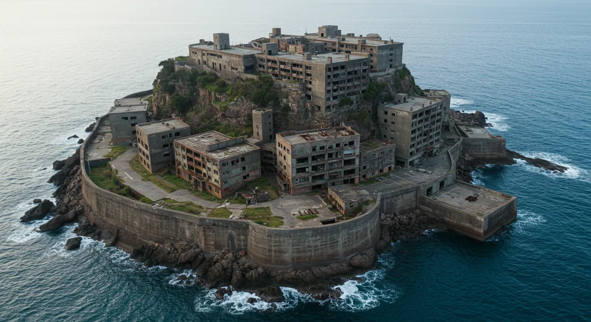
Hashima Island measures approximately 480 meters in length and 160 meters at its widest point, covering roughly 6.3 hectares of reclaimed land. The island's compact footprint supported over 5,000 residents at peak density in 1959, making it one of the most densely populated places on Earth. The entire perimeter can be walked in under fifteen minutes, though visitor access remains restricted to designated paths along the southern pier.
The island's footprint expanded dramatically through land reclamation between 1897 and 1931. Mitsubishi Corporation built concrete sea walls and filled the shallow waters surrounding the original reef, transforming a rocky outcrop barely 120 meters across into a fortified industrial platform. Each expansion pushed the shoreline outward, eventually creating the angular profile that resembles a warship when viewed from Takashima to the east. Hashima Island dimensions place it among Japan's smallest inhabited islands, yet the vertical architecture compensated for limited ground space. Nine-story apartment blocks lined the perimeter, while the mine shaft descended 600 meters below sea level—ten times deeper than the island is wide. The 5,259 residents recorded in the 1959 census translated to roughly 835 people per hectare, a density exceeding central Tokyo at the time. Rooftop shrines, underwater tunnels, and a six-story school occupied every available surface, leaving no unutilized land. Gunkanjima's size made self-sufficiency impossible. Supply boats docked at the southern pier daily, delivering food, coal for heating, and construction materials. The concrete buildings pressed so close together that sunlight rarely reached ground-level alleys, and the lack of green space meant children played on rooftops and designated concrete yards. When the mine closed in 1974, the population evacuated within three months, abandoning an infrastructure designed for maximum occupancy on minimal land. Today's tour routes cover approximately one-tenth of the island surface. The 650 JPY landing fee grants access to three observation points along the southern seawall, each offering views of the deteriorating apartment blocks and the central mine shaft entrance. Weather permitting, boats depart from Nagasaki Harbor mid-morning, and the 40-minute crossing provides the clearest perspective on how big Hashima Island truly is—a man-made monument barely visible against the horizon, yet dense enough to house a small city.
“The 5,259 residents recorded in 1959 translated to roughly 835 people per hectare, a density exceeding central Tokyo at the time.”
Understanding How Big Is Hashima Island: Dimensions and Scale
Hashima Island, often referred to as Gunkanjima or Battleship Island, is a compact, man-made site defined by its intense industrial history. Despite its modest footprint, the island was once home to one of the highest population densities in the world.
Total surface area
The island spans approximately 6.3 hectares (16 acres) in total size.
Physical dimensions
It measures roughly 480 meters in length and 160 meters in width.
Land reclamation origins
The island was expanded through six major land reclamation projects, which eventually tripled its original footprint.
Nickname source
The island earned its name, Battleship Island, because its seawall and concrete buildings resemble the silhouette of the Japanese battleship Tosa.
Historical density
At its peak in 1959, over 5,000 residents lived on this small site, resulting in extreme population density.
Developmental scale
The island was once a dense network of concrete apartment blocks, schools, and industrial facilities supported by undersea coal mines.
What You Can See Within the Limits of How Big Is Hashima Island
Visitors to Hashima Island are restricted to designated pathways that reveal the extreme architectural density within the island's limited footprint. These observation points provide direct views of the abandoned residential and industrial structures that define the skyline.
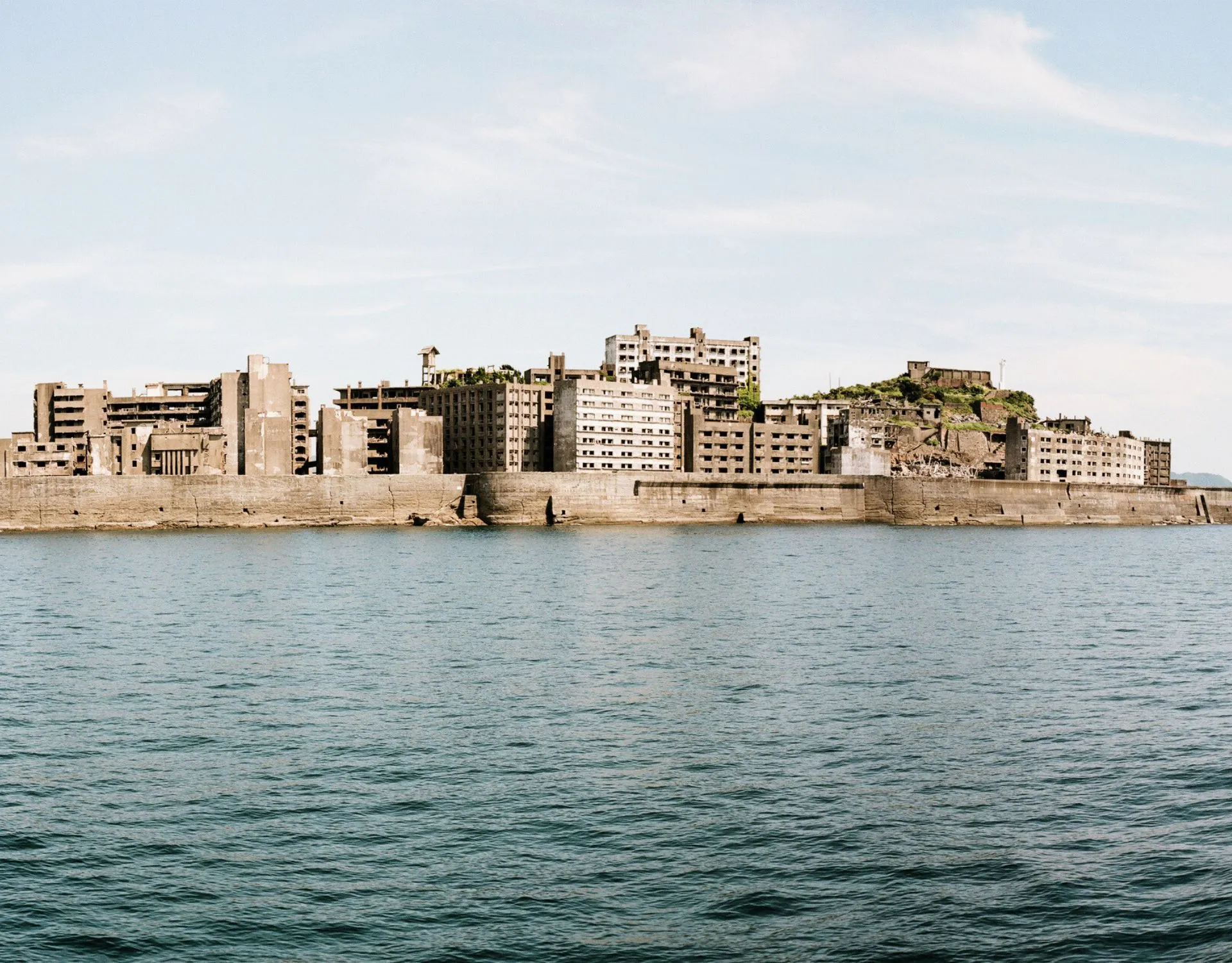
Sea Wall
The fortified concrete perimeter designed to protect the island from harsh ocean conditions.
Walk the path carefully to observe erosion patterns along the base.
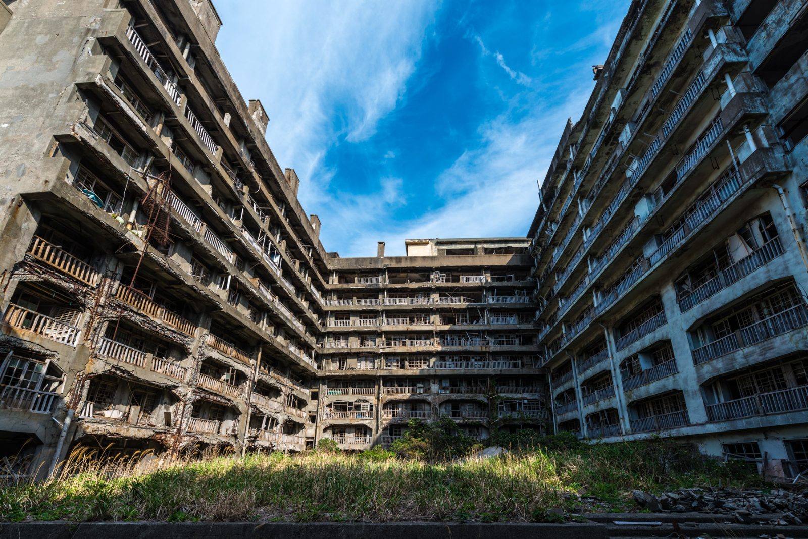
Building No. 30
The oldest reinforced concrete apartment block on the island, constructed in 1916.
Look upward from the walkway to appreciate the scale of its internal courtyard.
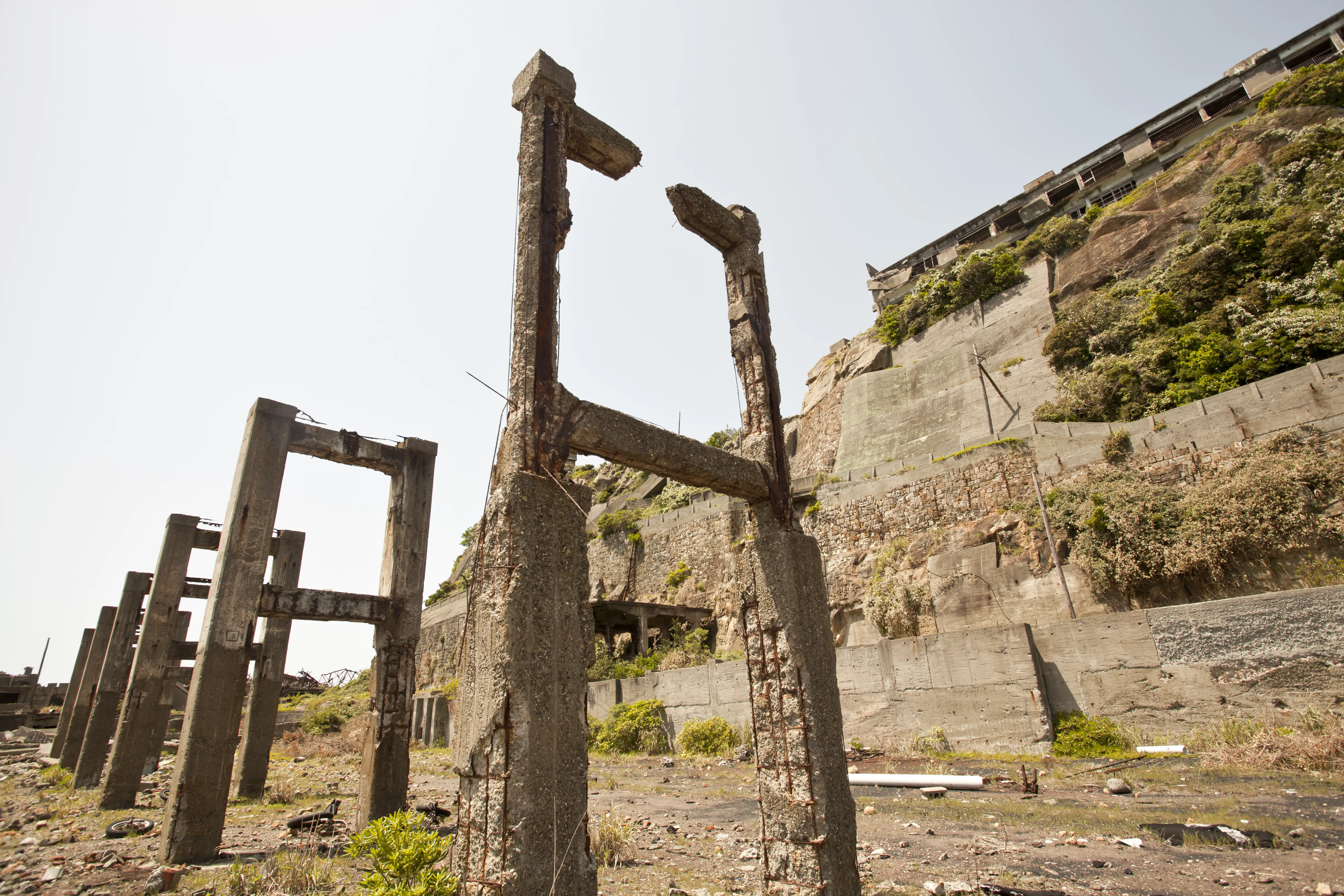
Conveyor Belt Ruins
Remnants of the industrial infrastructure once used for coal transport.
Use a wide lens to capture the structure against the main apartment blocks.
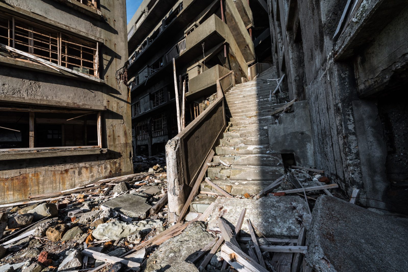
Stairway to Nowhere
Collapsed internal staircases visible through the window frames of the primary housing units.
Observe how nature has begun to integrate with the concrete frame.
Entrance Fees for Visiting Hashima Island
Access to Hashima Island requires a mandatory landing fee paid by every visitor. This fee is separate from the cost of the boat tour passage required to reach the island.
Every visitor pays a 650 JPY landing fee, with the final cost determined by the boat tour operator selected for transport.
Opening Hours and Visiting Schedule for Hashima Island
Hashima Island is open to visitors daily, provided that sea conditions allow for safe boat travel and tours are booked in advance.
| Monday | 09:00–17:00 | |
|---|---|---|
| Tuesday | 09:00–17:00 | |
| Wednesday | 09:00–17:00 | |
| Thursday | 09:00–17:00 | |
| Friday | 09:00–17:00 | |
| Saturday | 09:00–17:00 | |
| Sunday | 09:00–17:00 |
How to Reach Hashima Island for Your Tour
Hashima Island is located off the coast of Nagasaki and is only accessible by boat. Visitors must depart from Nagasaki Port via authorized tour operators to reach the island.
JR Nagasaki Main Line to Nagasaki Station
Nagasaki Bus to Nagasaki Shinchi Terminal
Authorized tour operator from Nagasaki Port
Check availability
Frequently asked questions about how big is hashima island
Everything you need to know about how big is hashima island